Posts

Showing posts with the label GPS tracker devices

Using the GNIS for your GPS Tracking Device

Image
When you start using a GPS Tracking Devices , you’ll soon discover that it’s pretty numbers-oriented. There’s time, speed, distance, altitude, and (of course) the location coordinates. But quite often you’ll want names to go with those numbers. Or you might need to convert those coordinate numbers into another format. Read here to discover how to locate places by their names and get their coordinates (and other information) and how to easily convert coordinates from one coordinate system to another. Finding Your Way with Online Gazetteers Sometimes you need a little bit more information about a location. You know a place name, but you don’t know exactly where the place is  located. You’ve heard about a place but don’t know whether it’s a mountain peak,  a river, or a town. You generally know where a place is, but you need the exact latitude and longitude or Universal Transverse Mercator (UTM) coordinates. In these cases, you can turn to a gazett...

Using GPS Tracking Devices Mapping Software

Image
GPS Tracking Device that support maps come with a basemap of the region the GPS receiver was sold in (such as North America or Europe) that shows city locations, highways, major roads, bodies of water, and other features. Precisely what the basemaps display varies by manufacturer and model. Although base- maps do provide general information, some GPS receiver users want more detailed maps that show city streets, topographic features, marine navigation aids, or places outside the United States. How long building a map takes depends on the size of the area that you select, how much map detail you want to include, and how fast your PC is. This can range from a minute or less for small areas (such as a metropolitan area) to five or ten minutes for a large map (such as one that includes many different states). How much time it takes to upload a map into a GPS receiver also depends on the size of the area you select and how the receiver stores maps. If you’re uploading a large map from...

Personal Tracker with an electronic altimeter

Image
Altimeter The elevation or altitude calculated by a GPS receiver from satellite data isn’t very accurate. Because of this, some GPS units have altimeters, which provide the elevation, ascent/descent rates, change in elevation over distance or time, and the change of barometric pressure over time. (The rough-and-ready rule is that if barometric pressure is falling, bad weather is on the way; if it’s rising, clear weather is coming.) Calibrated and used correctly, barometric altimeters can be accurate within 10 feet of the actual elevation. Knowing your altitude is useful if you have something to reference it to, such as a topographic map. Altimeters are useful for hiking or in the mountains. On Personal GPS Tracker with an electronic altimeter/barometer, calibrating the altimeter to ensure accuracy is important. To do so, visit a physical location with a known elevation and enter the elevation according to the directions in your user’s guide. Airports are good places to calibrat...

How to carry your Mini GPS Tracker on foot

Image
If you use a GPS receiver for your outdoor workouts, one of your biggest decisions will be how to carry the GPS receiver. The simplest way is just to hold it in your hand, if it’s free. Of the number of other different ways to carry a GPS receiver, the best carry methods will Provide optimal GPS satellite signal reception: Where you work out might dictate how you carry your GPS receiver. If you live on the plains (flat) without any trees and have excellent satellite reception, you have more options than in the Pacific Northwest (heavy tree canopies). Be comfortable : Carrying a GPS receiver should not distract you from your workout. However you carry it, it should be comfortable, and you really shouldn’t notice carrying or wearing it. Here are some different ways to carry a GPS receiver while working out. How you carry a GPS receiver usually ends up being a personal preference. Try a few of these methods to see which one works best for you. Armbands Armbands, especially w...

GPS Tips for Specific Sports

Image
GPS for paddlers and rowers For athletes who row or paddle for fitness or in competitions, a Personal GPS Tracking Device provides a quick and easy way to gauge distance and speed without installing a speedometer in your boat; they’re also cheaper than venturi speedometers. I’ve seen GPS receiver cases mounted to canoes, kayaks, and rowing shells using Velcro, duct tape, webbing, and custom-made fiberglass holders, all optimally placed to let the athlete read the screen and click buttons. Obviously, make sure that your GPS receiver stays dry. Your GPS receiver should have an IPX 7 rating (submersible for 30 minutes in one meter of water). Regardless of the rating, I use a waterproof bag. Voyageur bags, priced under $25, are durable, watertight, and buoyant; it’s easy to see the screen and use the receiver while it’s in the bag.  If you’re using a GPS receiver in any type of watercraft, tether the GPS receiver (or its case or bag) to yourself or the boat. This is good insuranc...

Overview - How GPS Tracking Device Was Designed to Work

Image
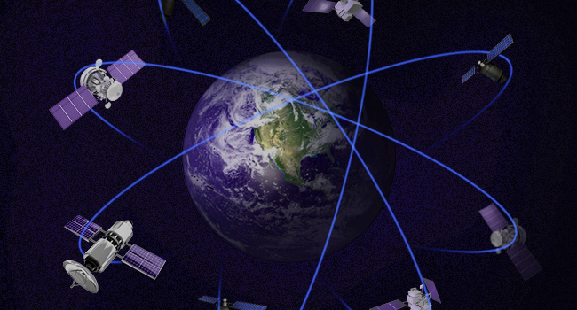
GPS Tracking Devices was designed to work outdoors. The signal from the GPS satellites is extremely weak, and the satellites are far away. The total radiated power from each satellite is just 27W, about the same power from a dim lightbulb. The satellites are more than 20,000-km high (about 55 times higher than the space shuttle flies). When the signal reaches the GPS receiver on the Earth, the received signal power is about 100 attowatts; “atto” means 10–18, and it is not a commonly used prefix. We typically express such low powers in terms of decibels. But it is useful to mention the attowatt just this once, to get a feel for how weak the received GPS signal really is. The received signal power is 100 attowatts when the receiver is outdoors; when the receiver moves indoors, the signals rapidly get weaker, by 10–100 times in a house,and by 100–1,000 times or more in a large building. However, it is not just indoors where GPS has signal problems; the weak signal is a problem outdoors...

GIS/GPS/GSM-based system for ambulance management

Image
In terms of “integration,” GNSS services can be exploited as a building block for dedicated emergency networks. A representative example for this is the SAR service of GALILEO, which integrates the GNSS with the emergency COSPAS-SARSAT system. Other examples have been reported, such as a GIS/GPS/GSM-based system for ambulance management and emergency incident handling in the Greek prefecture of Attica. The integrated system is expected to operate in the National Center of Immediate Assistance (ETAK in Greek), which deals with emergency medical incidents by coordinating and routing ambulances to appropriate hospitals and offering medical care to patients during their transport to hospitals.  A further system, the Taiwan E-Vanguard for Emergency (EVE), provides help in rescue and first-aid work in rescue operations. EVE consists of rescuers equipped with wearable PDAs, medics with laptops plus GPS, a rescue command center controlled by leaders of rescue and medical teams, and a ...

Electronic tracking devices Applications in Biology

Image
In recent years, new wildlife tracking and asset GPS tracking device have become available, allowing remote data capture from a steadily increasing number of taxa, species and individual animals. This has resulted in a substantial increase in the volume of data gathered by researchers, environmental monitoring programs and public agencies. In the future, one can expect an almost exponential increase in collected data as new sensors, e.g. to monitor health status, interactions among individuals, or other animal-centred variables, are integrated into current biologging systems on animals. Data can be remotely transferred to operators (e.g. using Global System for Mobile Communications (GSM) networks or satellite systems such as Argos, Globalstar and Iridium), making near real-time monitoring of animals possible. Furthermore, positional information can now be complemented with a wide range of other information about the animals’ environment made available by satellite remote sensing, met...

Electronic tracking device can be used to track almost any type of object

Image
For ages people have been looking for ways to find locations and identify directions to different places. It all began in the first century when the Chinese used lodestone ladles whose handles always pointed towards the south no matter what direction they were placed in. In the year 1978, a Block-I GPS satellite was launched. It was basically used for defense purposes. Another milestone in the GPS system is the development of Topologically Integrated Geographic Encoding and Referencing (TIGER) a digital map that allowed users to create virtual maps. This digital map was released in 1989, and sometime before that in 1983, the US president had declared that the GPS system would be made public for everyone to use. Both these factors speeded up the process of the designing and development of GPS-enabled tracking devices in the world. Over the next few decades, more research institutions and IT-based companies began to create devices based on GPS. Now, GPS has become so commonplace that...

How GPS Works —— The secrets of Magnetic GPS

Image
It’s fun to uncover something that you aren’t supposed to know about — many software applications and movies on DVD contain what are known as “easter eggs.” However, imagine finding something that you aren’t supposed to find that turns out to be useful and informative. In this article, we are going to hunt for GPS easter eggs, delving into the secrets that lie behind the standard menus on your GPS unit to find useful features and diagnostic screens that can give you information about your system and troubleshoot problems that you might have. There’s a lot of information to find — technical information, diagnostic information, and more. Let’s begin our tour of the secrets of Magnetic GPS . How GPS Works The basic principle behind GPS is straightforward: The GPS receiver picks up a signal from three or more of the satellites and then uses this information to calculate the distance to the satellites. This information is, in turn, used to determine a location on the globe where th...

Rearview Mirror DVR Tutorial - Smart Car Device

Image
What is Rearview Mirror DVR? Rearview mirror DVR is a high definition dash cam that records 720p/1080p at 30fps/15fps, it has independent operating system and running space, users can install software, game and navigation applications which provided by the third party servicers, and via wifi or mobile communication network to realize wireless internet access. At the same time, it can also provide many functions such as driving records, GPS positioning, reversing visual, bluetooth hands-free phone and so on. What is  Rearview Mirror DVR Like? What makes this dash cam interesting is that, in our eye, rearview mirror DVR looks like an oversized rearview mirror (one of types shown as the figure). Many people would not realize that this dash cam was installed in a vehicle. In fact, it has a screen built into the mirror and the default setting is to have the screen always on. This is not ideal for driving so you should set screen-saving mode to 1, 3 or 5 minutes. This turns ...