There are various kinds of GPS Tracking Device flooding the market in the recent times
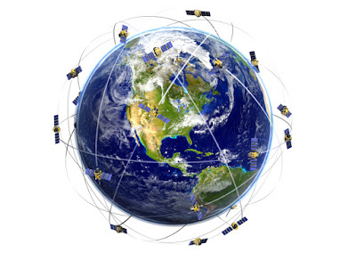
Ancient travelers relied on celestial objects, such as stars, to find their way. GPS users also use celestial objects—satellites—to navigate. There are, of course, vast differences between a star and an earth-orbiting man-made object. You observe a star to navigate; a satellite is invisible to the naked eye, but you use its position data, or ephemera, to navigate. Modern navigators no longer have to wait for nightfall and clear skies, and, thanks to atomic clocks, they can receive precise position data continuously. According to the National Academy of Sciences, in 1957 scientists observing the newly launched Sputnik realized they could predict its position by measuring the increase and decrease in frequency of its radio signal as it orbited the earth. This observation confirmed that a satellite’s position in space could be accurately determined from the ground, which meant a satellite could determine the accurate position of an object on or above the ground, such as a hiker or a hang ...