Posts

Showing posts with the label electronic tracker

Information Systems Support of Bike Sharing Systems

Image
Over the past years, BSS(Bike Sharing Systems) have evolved from unsupervised to fully automated systems. In the beginnings, bike sharing suffered from anonymous use that led to theft. In recent years, the implementation of information systems in bike sharing overcame theft and enabled easy and quick access supporting rentals and returns at automated stations providing one-way trips. The implementation of BSS is rapidly growing. According to Midgley (2009), about 80 systems with almost 27,000 bikes and more than 4600 stations were in operation in May 2009. About 400 BSS have been introduced in Europe during the last 10 years. Markets in America and Asia are catching up.     In order to give more details on BSS, a brief overview of bike sharing evolution  is presented. Furthermore, the automated service process enabled by information  systems is discussed. Information systems also provide a vast amount of data  reflecting the mobility behavior in BSS. For ...
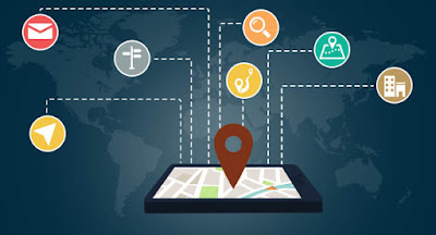
Electronic Tracker positioning at present and in the future

Image
Positioning with data link is not the same as referenced positioning (a method that allows measurements from more than one receiver to be combined and processed together in order to enhance accuracy), This external information includes measurements from other receivers, but it also includes other information which can be used to improve not only accuracy, but also other parameters in the specification, such as TTFF and sensitivity. It is very important for many applications to be able to provide instant positioning, i.e. to avoid the necessity of tracking a satellite signal and reading a navigation message. It takes up to 36 s to read a complete navigation message for a GPS L1 signal to ensure the decoding necessary for positioning data. If navigation message data are available through some other data link, it is still necessary to decode a time mark from the navigation message, which may require up to 6 s. BGPS (and AGPS before that) are very important for many applications because th...

Uploading Firmware Revisions to Your Motorcycle GPS Tracker

Image
Just like software vendors, GPS Tracking Devices manufacturers find bugs and add enhancements to their products. New versions of a GPS receiver’s operating system can be upgraded through the receiver’s firmware (the updateable, read-only software that’s embedded in a hardware device). Check that your GPS receiver’s firmware is current every few months or so, especially if your receiver is a newly released model. GPS manufacturers offer free downloads of firmware upgrades on their Web sites, and these bug-fixes or new features can definitely make your GPS receiver perform better. To upgrade your firmware 1. Check the current version of your GPS receiver firmware. Sometimes this is displayed when the GPS receiver is turned on, or it might be shown on an information page. Consult your user’s guide or the manufacturer’s Web site for specific instructions on how to get this information for your model. 2. Visit the manufacturers’s Web site and go to the software updates sec...

Becoming Familiar with Your Mini GPS Tracker

Image
After considering all the options, making your list, checking it twice, and finding out which GPS receivers are naughty and nice, you’ve finally come to that blessed event where you’re the proud owner of a GPS receiver. But before you step out the door for a 100-mile wilderness trek or cross-country road trip, intent on relying on your new electronic gadget as a guide, be sure spend some time getting to know your Mini GPS Trackers . A good place to start your GPS familiarization process is with the user manual. Many GPS receivers have a quick-start guide that gets you up and running in a matter of minutes. These guides are perfect for those impatient, got-to-haveit-now people; however, I suggest that you also take the time to read the full user manual. Otherwise, you could miss out on some important information contained in the full user manual. In addition to the user manual, this section will also help you become familiar with your GPS receiver so you can get the most out of it. ...

Using a Personal GPS Tracker for training

Image
I do a lot of running and biking, every now and then entering some pretty crazy endurance events like ultramarathons, Ironman triathlons, and adventure races. A GPS receiver can make a pretty good training partner: You can use it for lots of things besides helping you avoid getting lost. This Blog is for athletes who exercise outside in the fresh air (sorry, no gym tips) and want to know how to incorporate GPS receivers into their workouts. A Portable GPS not only helps you successfully get between Point A and Point B but is also handy for staying found. These tips apply to almost any sport: Measure distances over known courses : Instead of guessing the course or route length, you can use a GPS receiver to measure the distance with a fair amount of accuracy. Better understand the elevation of courses : Elevation data can give you a more accurate sense of how flat or hilly a course really is. Even if your GPS receiver doesn’t have a barometric altimeter (which is required for...

How to change the default system settings in Portable GPS

Image
Changing Receiver Settings After you initialize your GPS receiver for the first time, you need to change a few of the receiver’s default system settings. You only need to do this once, and a few Small GPS Tracker will prompt you to make some of these changes as part of the initialization process. These changes are mostly to customize settings based on your location and needs. Check your user manual for specific information on how to change the system settings described below. Although GPS receivers have a number of system settings that you can change, here are some of the important settings you’ll want to initially adjust: Time: Your GPS receiver gets very precise time data from atomic clocks aboard the satellites, but it’s up to you how the time will be displayed. You need to specify • Whether to use 24-hour (military time) or 12-hour (AM and PM) time • Whether Daylight Savings Time is automatically turned on and off • What your time zone is (or your offset from...

Why GPS is a primary source of data for GIS

Image
While this is a text on how to use GPS in GIS–and hence is primarily concerned with positional issues, it would not be complete without mentioning what may, for the average person, be the most important facet of GPS: providing Earth with a universal, exceedingly accurate time source. Allowing any person or piece of equipment to know the exact time has tremendous implications for things we depend on every day (like getting information across the Internet, like synchronizing the electric power grid and the telephone network). Further, human knowledge is enhanced by research projects that depend on knowing the exact time in different parts of the world. For example, it is now possible to track seismic waves created by earthquakes, from one side of the earth, through its center, to the other side, since the exact time may be known worldwide. GPS AND GIS The subject of this blog is the use of GPS as a method of collecting locational data for Geographic Information Systems (GIS). Th...

Unconventional dynamic differential GPS orbit solutions

Image
The first of these unconventional GPS applications to be seriously examined was precise orbit determination (POD) in support of high precision ocean altimetry. A global differential GPS technique for achieving sub-decimeter orbit accuracy on the joint U.S.- French TopexlPoseidon mission was first proposed at the Jet Propulsion Laboratory in 1981. The basic elements of the proposed differential GPS system-a small global ground network, a precision flight receiver, the GPS constellation, and an analysis center-are depicted in the picture below. Over the years, a variety of refinements to the proposed orbit estimation technique, evaluated through simulation studies and covariance analysis, revealed the surprisingly rich potential of  tracking device  for few-centimeter tracking of orbiters at low altitudes. The Topex/Poseidon ocean altimetry satellite was launched into a 1300 kIn orbit on an Ariane rocket in August of 1992. It carried an experimental dual-frequency P-code ...

Applications of spaceborne GPS to Earth science

Image
With the recent completion of the Global Positioning System constellation and the appearance of increasingly affordable spaceborne receivers, GPS is moving rapidly into the world of space flight projects. Indeed, owing to the great utility and convenience of autonomous onboard positioning, timing, and attitude determination, basic navigation receivers are coming to be seen as almost indispensable to future low earth missions. This development has been expected and awaited since the earliest days of GPS. Perhaps more surprising has been the emergence of direct spaceborne GPS science and the blossoming of new science applications for high performance geodetic space receivers. Applications of spaceborne GPS to Earth science include centimeter-level precise orbit determination (POD) to support ocean altimetry; Earth gravity model improvement and other enhancements to GPS global geodesy; high resolution 2D and 3D ionospheric imaging; and atmospheric limb sounding (radio occultation) to...

Some common antennas used for GPS applications

Image
GPS receivers are composed of three primary components: the antenna, which receives the radio frequency (RF) broadcasts from the satellites; the downconverter, which converts the RF signal into an intermediate frequency (IF) signal; and the baseband processor or correlator, which uses the IF signal to acquire, track, and receive the navigation message broadcast from each SV in view of the receiver. In most systems, the output of the correlator is then processed by a microprocessor (MPU) or microcontroller (MCU), which converts the raw data output from the correlator into the positioning information which can be understood by a user or another application. The sections below provide an overview of the three key components of a GPS receiver, describing in generic terms the functionality and capabilities typically found in these systems. As the capabilities of the MPU or MCU needed to process the correlator output is largely dependent on the needs of the applications and the particular...