Posts

Showing posts with the label asset tracker

The advantage of using GPS Tracker for mining

Image
GPS Tracking Device has proven a significant increasing in productivity and improved on-site safety in mining activities, e.g., mineral and aggregate extraction with especial incidence in iron ore and coal extraction and transport tasks. In open pit mining, accurate GPS and GNSS(Global Navigation Satellite System) is useful for tasks such as machine guidance, grading, dozing, drilling, collision avoidance, surveying, and fleet management. GPS can be used in open cut mining operations as long as the satellites can be viewed in a direct line of sight. Tests undertaken at two mines, under worst case conditions, show that GPS works well in most situations. Close to highwalls (within 3-4 metres) depending on the positioning of the satellites at any given time, the GPS system dropped back to two dimensional fixing, with only three satellites visible. GPS needs four satellites for a three dimensional fix. There are many areas where GPS technology can improve the productivity of coal mines. ...

GPS tracker becomes more a part of our daily lives

Image
GPS is such an extremely important technology! It is no exaggeration to say that GPS is revolutionizing aspects of many fields, including surveying (slashing the costs of many kinds of survey efforts and bringing surveying to parts of the world where surveys are nonexistent, highly inaccurate, or long since outdated), the natural resource fields (providing rapid and far more accurate collection of field natural resource data of many kinds), and municipal planning (providing for the updating of all kinds of records based on accurate field checking), to name only a few.  electronic tracking device  is making practical the kinds of data collection which were simply out of the question only a few years ago because the necessary skilled teams of field personnel were unavailable and the costs of accurate field data collection were beyond the means of virtually all organizations which needed these kinds of data.  GPS is changing all that. Use of the kinds of methods taught ...

Some figures of tracking device penetration in various markets

Image
During the last few years the GNSS industry has seen continuous growth in the number of firms that use satellite navigation to create value-added services, ranging from GIS and land surveys to LBS and ITS. This trend toward the provision of consumer services was forecast in many studies carried out in the 1990s, later confirmed by recent research (mainly before selective availability was deactivated). It was reported that in terms of revenues, the aviation market for  GPS tracking device  had a growth of 10%, the marine market 11%, the military and timing markets both just under 25%, and the land market just over 24%. Approximately 62% of the total North American GPS market revenue was from land applications. With the turning off of SA the improved accuracy has encouraged the implementation of new navigation services. A further shift toward service provision is due to the modernization of portable tracker and the European navigation activities, with the introduction of EG...

Using tracking device for logistics information management system

Image
The electronic tracker can be quickly given the position and velocity, but not to The target property of their geographical environment and spatial information associated with a description ,while the GIS is just to meet the requirements of this complementarily. Obviously, if only isolated the point of location information without geographic reference and other supporting information required, point position information on the application of logistics management is not very meaningful. With an electronic map(GIS technology) car, keep the city urban area map and save it up. It is accuracy and the amount of the information can be much higher than the printing of the urban traffic plan, but the car location achieved by drivers with the scene around by. Adding a portable GPS tracking, car location, driving direction, speed and other information can be displayed at any time in the electronic map.In short, using GPS and GIS technology in logistics information management system can use the G...

GPS Tracking Solution - GPS–Galileo–Glonass Constellations

Image
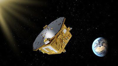
Despite similarities, there are some issues in the consistency GNSS issues as you know. For example, you may recall that the roll out of the new systems is not coordinated. In other words GPS ( GPS Tracking Device  ) Modernization, GLONASS replenishment, and QZSS and Galileo deployment have not been synchronized. Despite much cooperation there is no clear agreement among nations that launches and operational capabilities of GLONASS, GALILEO, GPS, QZSS, and Beidou will happen in the same time frame. Also there are differences between GLONASS and GPS regarding CDMA and FDMA. There are also differences in the time standards between the two systems. Not to mention the overlap between the GPS M-code and Beidou. It is important that these inconsistencies are worked out technologically because apart from the less sophisticated applications for GNSS interoperability will be required. For the full potential of the system to realize multiple GNSS, frequencies will need to work together. In...

The future of electronic tracking device

Image
So what is coming? Some day there may be as many as 80 satellites from GPS, GLONASS, GALILEO, QZSS, and others. If so the systems will provide users with a variety of signals and codes. The availability of many more satellites will enable new applications in areas where the current lack of satellites has been a hindrance. For civil users, Personal GPS tracker will provide more protection from interference, ability to compensate for ionospheric delays with pseudoranges, and wide-laning or even trianing capabilities. For military users, there will be greater antijam capability and security. For everybody, there will be improvement in accuracy, availability, integrity, and reliability. It looks as if the GNSS is on its way. So it is no surprise that there is great anticipation from a business perspective, but from a user’s point of view the situation is not unlike the advent of GPS more than 30 years ago. Much is promised but little assured. New capabilities will be available, but exac...

GPS tracking solutions - About GPS Surveying Techniques

Image
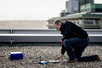
If a static tracking device control survey is carefully planned, it usually progresses smoothly. The technology has virtually conquered two stumbling blocks that have defeated the plans of conventional surveyors for generations. Inclement weather does not disrupt GPS observations, and a lack of intervisibility between stations is of no concern whatsoever, at least in postprocessed GPS. Still, electronic tracking devices is far from so independent of conditions in the sky and on the ground that the process of designing a survey can now be reduced to points-per-day formulas, as some would like. Even with falling costs, the initial investment in GPS remains large by most surveyors’ standards. However, there is seldom anything more expensive in a GPS project than a surprise. New Design Criteria These upgrades in accuracy standards not only accommodate control by static GPS; they also have cast survey design into a new light for many surveyors. Nevertheless, it is not correct to say th...

Vehicle GPS tracking systems and Vehicle localization

Image
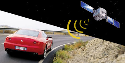
GPS Declassified examines the development of GPS from its secret, Cold War military roots to its emergence as a worldwide consumer industry. Drawing on previously unexplored documents, the military rivalries influenced the creation of GPS and shaped public perceptions about its origin. Since the United States’ first program to launch a satellite in the late 1950s, the nation has pursued dual paths into space—one military and secret, the other scientific and public. Among the many commercial spinoffs this approach has produced, GPS arguably boasts the greatest impact on our daily lives. Told by the son of a navy insider—whose work helped lay the foundations for the system—and a science and technology journalist, the research and technological advances required for the development of GPS. GPS moved from the laboratory to the battlefield to the dashboard and the smartphone, and they raise the specter of how this technology and its surrounding industry affect public policy. Insights into h...

Animal biotelemetry is driven by GPS Tracking Device

Image
We are currently seeing a golden age of unprecedented progress and discovery in movement research. The innovation in Global Positioning System (GPS) technology, combined with systems for remote data transfer, has particularly favored tracking device -based animal telemetry to become a standard in wildlife tracking. Three main processes are responsible for this rapid advancement: (1) the development of new tracking techniques to quantify movement, (2) powerful data analysis tools to examine key questions about movement and its causes and consequences, and (3) conceptual and theoretical frameworks for integrating movement research. Many new tools have been developed recently to record the movement of various organisms vii with levels of accuracy, frequency, and duration that are much higher than they were just a few years ago. This has strongly improved our capacity to track insects, fish, and other relatively small organisms. However, arguably the most dramatic development in animal bio...

Electronic tracking devices Applications in Biology

Image
In recent years, new wildlife tracking and asset GPS tracking device have become available, allowing remote data capture from a steadily increasing number of taxa, species and individual animals. This has resulted in a substantial increase in the volume of data gathered by researchers, environmental monitoring programs and public agencies. In the future, one can expect an almost exponential increase in collected data as new sensors, e.g. to monitor health status, interactions among individuals, or other animal-centred variables, are integrated into current biologging systems on animals. Data can be remotely transferred to operators (e.g. using Global System for Mobile Communications (GSM) networks or satellite systems such as Argos, Globalstar and Iridium), making near real-time monitoring of animals possible. Furthermore, positional information can now be complemented with a wide range of other information about the animals’ environment made available by satellite remote sensing, met...

Comprehensive Interpretation of Asset Tracker System Application

We can easily know what asset tracker system is, a tracking system or tracking app for your asset. This asset tracker system can be used to monitor all organizational assets. These asset tracker systems can help enterprises to examine all it happened, including when high value goods out and in or how the items be destroyed. Recently asset tracking and GPS technology have been a lot of publicity and even Microsoft company decided to receive an asset tracking company, It's clear to see that multiformity of the asset system or asset technology began to emerge because we all know the Microsoft so much money and power, and also so famous. But does it suitable for your office or your vehicle even for your family members? It still can be a question which is worth discussing. There are three categories of tracking environments, they are indoor, outdoor, and mixed. In term of asset tracker system, most of it is specific to indoor environment, there they are generally involves the track...

Application in Different Commercial Field of the Vehicle Tracking

Image
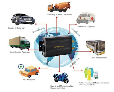
What is commercial vehicle? It can be defined as "any motorized road vehicle which by its type of construction and equipment is designed for, and capable of, transporting, whether for payment or not more than nine person, including the driver; or goods". Therefore, trucks, coaches, buses, vans and trailers are categorised as commercial vehicles. As a result of advances in the automotive industry, commercial vehicles have become more advances in technology and hence, reliability of individual critical components is an important factor for improving the overall reliability and quality of the vehicle. Thus the vehicle tracking system occured. These systems can enhance the security and efficiency of commercial vehicle operations. By closely tracking vehicles and asserts, opportunities for cargo and vehicle theft can be reduced, and dangerous goods can be given added security. What is the meaning of commercial vehicle tracking system? In brief, the behavior that tr...

GPS Tracking Device - Best Way to Keep People Safe

Image
Alzheimer's disease (AD) is a common disease in seniors, just one kind of progressive development of neurodegenerative diseases. People who gets this disease may appear memory impairment, aphasia, apraxia, agnosia, visuospatial skill impairment, executive dysfunction as well as personality and behavioral changes and other overall dementia performances, and the etiology GPS Tracking Device still can not be found. With the amount of seniors with AD, people becomes more and more worried about the safety of his old parents, then people launched yellow ribbon, it is separated family members for help after the signs, but also to pray for the blessing of their loved ones identified. people can tie the yellow ribbon with the seniors and if he/she is lost, police can send it to the home safely, but there appears a problem is that do not all the common people can know its meaning or the you can not guarantee the yellow ribbon on them, so it is not the best choice. Fortunately, location GPS...

3G GPS tracker Make You Live a Better Life

Image
Believe it or not, 3G GPS tracker has been penetrated to our daily life. You may don’t know how the GPS works, but you can’t deny that your life is closely related to GPS. When you drive your vehicle, entering a remote area and getting lost, the first thing you do is to turn the GPS for help. What is more, with the help of the 3G GPS tracker, you can find the exact location and go anywhere you want to go. Generally speaking, there are 24 satellites rotating around the earth, usually two rounds every day. Being in 6 different orbits, those satellites are positioning accurately and send the information back. By this way, we can conveniently get the location information as soon as possible. Another advantage of GPS is that it won’t be affected by weather, sunshine, rain or storm. Therefore, even it rains dogs and cats or winds terribly, the 3G GPS tracker can still be your good partner. According to the survey, the needs for 3G GPS tracker devices are increasing sharply. F...

Solution to Cargo Logistics Security by Motorcycle GPS Tracking Device

Image
Expensive goods and important products always need to be taken care of, but recently something improves the risk of goods. With the improvement of longer supply chains add touch points, the more and more holes appears, therefore, many criminal organizations aimed at the hole and the cargo security should concern. We can see that the cargo theft has increased 34% in 2014, and rose in Asia as well, according the professional research, the greatest risk of cargo theft currently exists in Brazil, Mexico, and South Africa, and the main method is hijacking. In fact, every market has own risk, and security managers should have a knowledge of different cultural normals and business practices. Such as some risks which caused by terrible weather, political unrest, natural disaster and others. Although people manufacture various solutions to address those risks continuously, but the criminals also continually adapt their tactics. A strategy which is a favorite tool of polices that called mot...

Jimilab Offers Asset Mannagement Solutions for You

Image
If you realized that your enterprises must manage assets beyond the company fleet, and ypu are lucky to read this article from Jimilab. Jimilab offers a suite of other tracking tools and capabilities. Each delivers powerful benefits in its own right, but they become even more beneficial when integrated with asset tracker system as part of a true enterprise platform. Trailer Tracking This function needs these elements: a GPS receiver, satellite transmitter, internal long-life battery, and antennas are packaged in a rugged enclosure. Together, these components empower you to monitor real-time trailer location, so you can maintain real-time control. Some enterprises even offer a temperature-monitoring capability for refrigerated trailers. Our patent-pending products rely on data compression algorithms, which allow for single-packet transmission of location, speed, direction of travel, and other data. Using a standard web browser, such as Google, you can view current and histori...